ATPL(A) 061 General NavigationRevision notes and practice questions
The subject falls into four blocks.
The first two are geometry, the last two applied arithmetic.
Everything else follows.
- 49 pages
- 417 questions
- €19.90 once
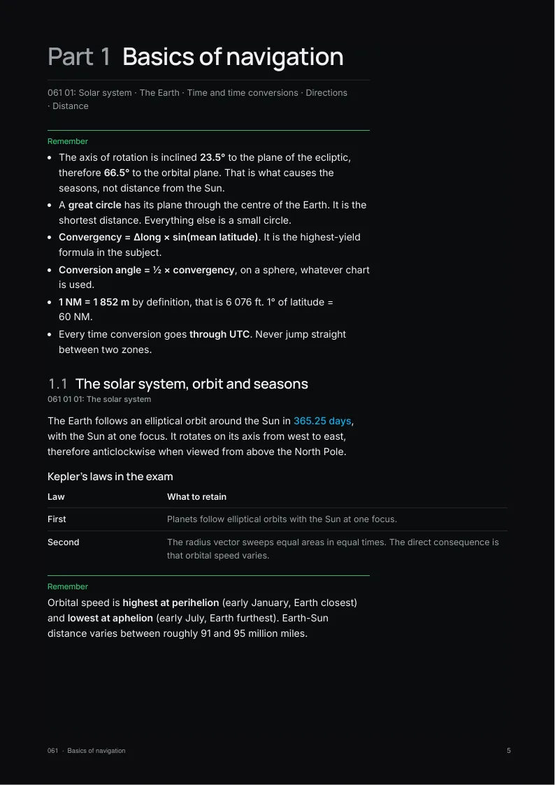
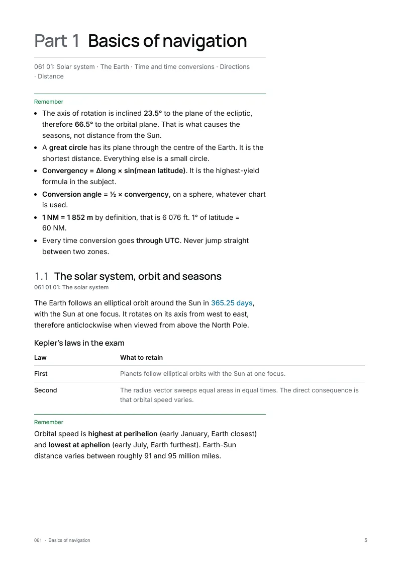
What the 061 notes cover
Written on the EASA Learning Objectives.
Checked against the primary texts.
An A4 PDF and a screen edition.
- Part 1061 01
Basics of navigation
The Earth, its coordinates, directions, distances and time. The foundation: master convergency and departure and half the subject falls into place.
- Part 2061 03
Charts and projections
Mercator, Lambert, polar stereographic. Three projections, three scale behaviours, three ways a great circle is drawn.
- Part 3061 04
Dead reckoning navigation
Triangle of velocities, temperatures, true airspeeds, altitudes and the navigation computer. This is the most computational part of the paper.
- Part 4061 05
In-flight navigation
Climb, descent, track correction, ETA revision and the flight log. Little theory, but reflexes to install.
- Part 5061 02
Visual navigation
Choosing checkpoints · Terrain, season and night · Threats and the lost procedure
Exam traps in 061 General Navigation
A sample from Appendix B.
The full list is in the notes.
Exam trap
- Mixing east and west longitude, east and west variation, port and starboard drift. Write the sign down before calculating.
- Using a magnetic heading with a wind given in true. VOLMET gives true, ATIS and ATC give magnetic.
- Reversing the conversion order. Going down is True → Magnetic → Compass.
- Confusing mean latitude, parallel of origin and standard parallel. Convergency uses mean latitude, the constant of the cone uses the parallel of origin.
- Forgetting cos(latitude) in the departure calculation.
- Applying 60 NM per degree to a longitude anywhere other than the equator.
The EASA 061 paper: 55 questions in 2 h 15. The exam rules →
A student asked: Why does the ATPL exam use 30 ft per hPa when the real value is 27?
A student asked: What are the main ATPL 061 General Navigation formulas?
Ten free 061 General Navigation questions
No account needed.
Pick an answer and the explanation opens.
The notes come with 1 month of all 417 questions and the mock exams.
1Using the data below, determine the track error angle.
Planned track: 197°(T)
Actual heading: 213°(T)
Actual in-flight drift: 12° leftShow the answer
Answer C. With 12° of left drift the aircraft actually tracks 213 − 12 = 201°(T). The track error angle is measured from the planned track to the track made good: 201 − 197 = 4°, and since the actual track lies clockwise of the planned one, the error is to the right. Comparing the heading directly with the planned track (16° right) forgets the drift.
2A ground feature is seen on a relative bearing of 315° and, 3 min later, on a relative bearing of 270°. The W/V is calm and the aircraft GS is 180 kts. What is the minimum distance between the aircraft and the ground feature?
Show the answer
Answer B. Relative bearing 315° puts the feature 45° left of the nose; 270° puts it exactly abeam on the left. When the angle off the nose doubles from 45° to 90°, the distance flown equals the distance to the feature. In 3 min at 180 kt the aircraft covers 180 × 3/60 = 9 NM. The feature is abeam at that moment, so 9 NM is also the closest point of approach.
3A pilot is planning a VFR cross-country flight using visual checkpoints. Which of the following would make the most suitable checkpoint?
Show the answer
Answer B. A checkpoint is useful only if it can be found quickly and cannot be confused with anything else, and that depends on contrast with what surrounds it. A feature that blends into its surroundings is hard to spot, one valley among many low hills looks like the next, and small lakes in mountains are numerous and easily mixed up.
4Given the following data for a conic projection chart in the northern hemisphere, calculate the change of longitude:
Great circle track from P to Q, at P: 112°(T)
Great circle track from Q to P, at Q: 316°(T)
Constant of the cone: 0.8Show the answer
Answer D. The track from Q to P at Q is 316°, so the track from P to Q at Q is 316 − 180 = 136°. The straight line changes direction by 136 − 112 = 24°, which is the chart convergency. Chart convergency = change of longitude × constant of the cone, so the change of longitude is 24/0.8 = 30°. 24° is the convergency itself, not the change of longitude.
5What is the Local Mean Time (LMT) at (35°25'S, 110°45'W) when the Coordinated Universal Time (UTC) is 18:34 on 4th September?
Show the answer
Answer D. 110°45' of longitude is 7 h 23 min of time (110.75 x 4 min = 443 min). West of Greenwich, local mean time is behind UTC, so subtract: 18:34 - 7:23 = 11:11 on 4 September. Adding the difference instead gives 01:57 on the 5th, the classic east/west mix-up.
6Using trigonometry and the data below, calculate the crosswind component (XWC) to the nearest knot.
Runway: 32
Wind (magnetic): 020°/25 kt
Variation: 15°EShow the answer
Answer A. Runway designators and the tower wind are both magnetic, so the variation plays no part. Runway 32 is about 320°(M) and a wind from 020° is 60° off the runway axis. Crosswind = 25 × sin 60° = 21.7, about 22 kt. Using the cosine gives the 13 kt headwind component instead, and applying the variation to the wind only distorts the angle.
7Using the information below, what is the TAS?
Pressure altitude: 6000 ft
OAT: +5°C
IAS/CAS: 115 ktShow the answer
Answer D. ISA at 6 000 ft is 15 − 12 = +3 °C, so +5 °C is ISA +2. Pressure at 6 000 ft is about 812 hPa, giving a density ratio σ = (812/1013) × (288/278) ≈ 0.83. TAS = CAS/√σ = 115/0.911 ≈ 126 kt, which is what the airspeed window of a flight computer gives with 6 000 ft set against +5 °C. Multiplying instead of dividing gives about 105 kt, and 115 kt ignores the density correction.
8A pilot is planning a VFR flight that crosses controlled airspace. Because of the airspace restrictions, part of the flight must be flown at low level. Which of the following is a navigation problem that may be met at low level on a VFR flight?
Show the answer
Answer B. The distance to the visible horizon depends on height, so at low level the pilot sees much less of the surrounding country and checkpoints come into view late. Rising ground and trees shorten the view further. Tall features are actually easier to see from low level, and the sensation at low height is one of higher, not lower, speed over the ground.
9Determine the two smallest map scales among the following:
A) 1:500 000
B) 10 cm = 10 NM
C) 5 inch = 10 NM
D) 1:110 000Show the answer
Answer B. Convert everything to a ratio. B: 10 cm = 10 NM = 1 852 000 cm, i.e. 1:185 200. C: 5 inches = 12.7 cm for 1 852 000 cm, about 1:145 800. The smallest scales are those with the largest denominators: A (1:500 000) and B (1:185 200); D is the largest scale of the four.
10What are the UTC and date when it is 23:00 LMT on 21st August at position A (11°00'N, 067°30'W)?
Show the answer
Answer D. Arc to time: 67°30' of longitude is 4 h 30 min. West of Greenwich, local time is behind UTC, so UTC is LMT plus the difference: 23:00 + 4:30 = 03:30 the next day, 22nd August. 18:30 comes from subtracting the longitude, and 03:30 on the 21st forgets that the time has passed midnight.
Keep practising.
The 061 notes come with 1 month of its 417 questions.
The pack: the notes of all thirteen subjects, with 2 months of all 6,295 questions.
Get 061 General Navigation
Pay once, no subscription.
Practise longer with its question bank.
The notes
€19.90 once
+ 1 month of its questions
PDF and screen edition, yours for life.
Updates included for 1 year.3 months of 061 questions
€39 once
€13.00 / month
All 417 questions with explanations and the mock exams, for this subject only. Questions only: the notes are not included.
The other subjects
- 010Air Law28 pages547 questions€7.90
- 021Airframe, Systems, Powerplant50 pages551 questions€19.90
- 022Instrumentation29 pages568 questions€11.90
- 031Mass & Balance30 pages328 questions€11.90
- 032Performance25 pages461 questions€7.90
- 033Flight Planning & Monitoring31 pages311 questions€11.90
- 040Human Performance46 pages578 questions€19.90
- 050Meteorology43 pages447 questions€19.90
- 062Radio Navigation29 pages512 questions€11.90
- 070Operational Procedures40 pages531 questions€15.90
- 081Principles of Flight39 pages516 questions€15.90
- 090Communications27 pages528 questions€7.90